Land acquisition project:
Weidatal
|
|---|

|
Land acquisition project:
Weidatal
|
|---|
|
|
The individual biotope types of the river floodplain section are currently formed as follows:
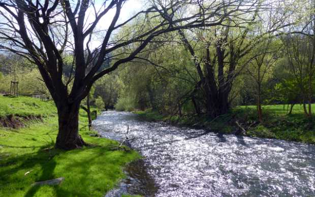
1. The River Weida section: An approximately 1.1 km, near-natural river section, on average some 10 m wide and 0.2 - 0.3 m deep. Structurally rich with near-natural riparian woodland and nettle/neophyte corridor, bank trees and undergrowth. The riverbed substrate of the Weida is pebbly to stony, the water clear and moderately fast-flowing, with extensive gravel banks in places. The river section is extremely rich in fish.
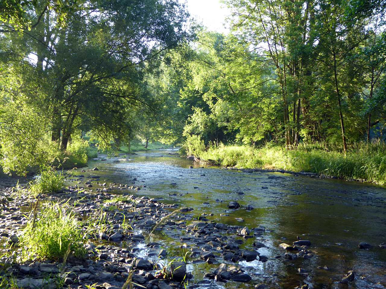
The near-natural Weidatal © SPA
2. Hillside woodland complex: This section consists of oak-hornbeam woodland on eutrophic fresh to moderately dry sites and oak (mixed) woodland on mesotrophic to oligotrophic dry and warm sites.
3. English Oak and Hornbeam woodland on eutrophic sites influenced by groundwater and stagnant water.
4. Oak-hornbeam woodland in the valley bottom on the right bank of the Weida on a predominantly level location with alternating humidity. Hornbeam dominates in the main layer, accompanied by English Oak and Small-leaved Lime. Some oak trees are up to 300 years old and have a variety of cavities excavated by the larger woodpecker species, Black and Green Woodpecker.
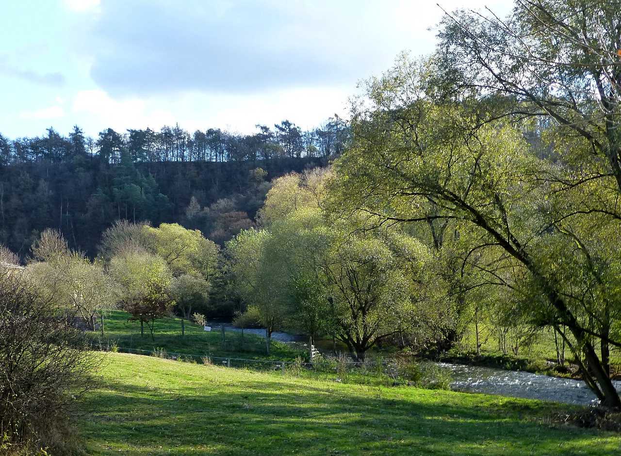
Our summerly hillside woodland on the Mühlberg © SPA
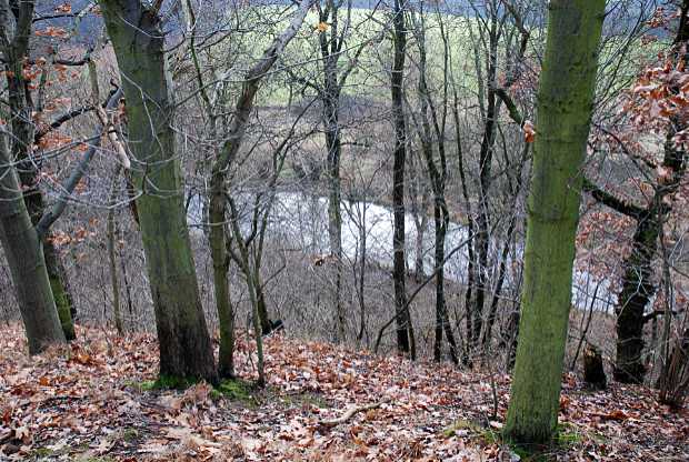
View from the autumnal hillside woodland on the Weida © SPA
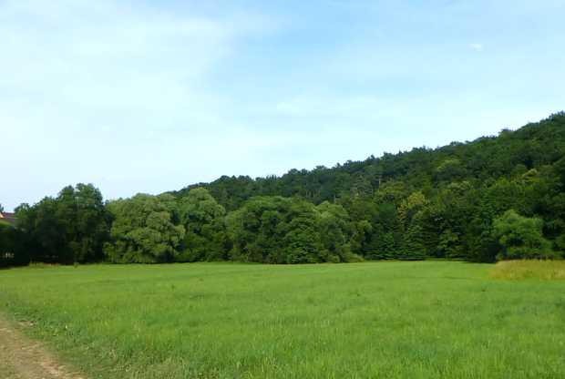
5. Fresh to moderately wet grassland with integrated damp grassland. In the middle-western part of the grassland, near the mill race, a wet area is enclosed, with a composition of species-rich rushes and sedges, including Hard Rush, Slender-tufted Sedges, Brown Sedge, Wood Clubrush and also a high proportion of the Cuckoo Flower.
The Mühlberg und riverbank meadows in the Weida Valley © SPA
The scenic uniqueness and beauty of this 1.1 km long section of the Weida river, starting at the ford of the former Mildenfurth monastery in the Veitsberg suburb of Wünschendorf/Elster upstream to the weekend house settlement Krähenholz (Weida City) with its wet meadows lining the river, the historic mill race and the hillside forests is however negatively affected by a variety of human conflicts of use.
The foundation-owned narrow path property between the Mühlgraben and the river Weida is degenerating into an ever wider bike path route, with all its biotope-damaging side effects, due to the increasing use by ever more powerful bicycles, discarded garbage in the Mühlgraben, tree root damage, torn off parts of plants, increasing soil compaction etc. Dog owners use the fringes of paths and meadows as dog toilets with adverse consequences such as over-fertilisation of the meadow borders, vegetation degradation, and hay loss as animal feed. This escalating and abusive use of paths taxes our patience and demands conflict-ending solutions.
For years, the East Thuringia state road authority has been planning a new supraregional 2.80 m wide asphalt cycle path route, that, according to the latest plans, traverses our hillside woodland steep slopes bordering the floodplain to the north. This would open the door to the littering of the extreme steep woodland slope with its centuries-old oak trees, the sealing of water-absorbent forest soil, salting by winter gritting services and disturbance caused by cyclists and motorcyclists to the permanent damage of this unique wild woodland biotope. For the past five years, we have campaigned for the realisation of an ecologically tolerable new cycle route. We will go, if necessary, through all court instances.
As part of the planned long-distance direct electric current routes from the Baltic (Mecklenburg-Western Pomerania) to Bavaria, considered necessary for the transition to renewable energy, the direct route SuedOstLink (Southeast Link) is to run through this scenic and ecological gem of the Weidatal. However, there are thousands of hectares of intensively used agricultural land to the west above the Weida Valley areas. The route is to be constructed partly above and partly underground. We have negotiated with the project planning company 50Hertz Transmission GmbH for almost three years to keep the construction and long-term damage to the wet meadow and floodplain biotopes and their biodiversity to a minimum. We hope to achieve this by an accompanying plan to include on-site ecologically valuable landscape conservation measures.
According to a preliminary 2008 study to determine the faunistic and floristic species potential, as well as the conservation sensitivity of the Weidatal between Weida and Wünschendorf/Elster, the diverse landscape structure with a wide variety of biotope types on an area of just under 28.0 ha (280,000 m²), unique in East Thuringia, is scientifically classified as follows:
The area has a high potential for developing habitats (biotopes) and a retreat for diverse flora and fauna species. It is host to occurrences of highly endangered species.
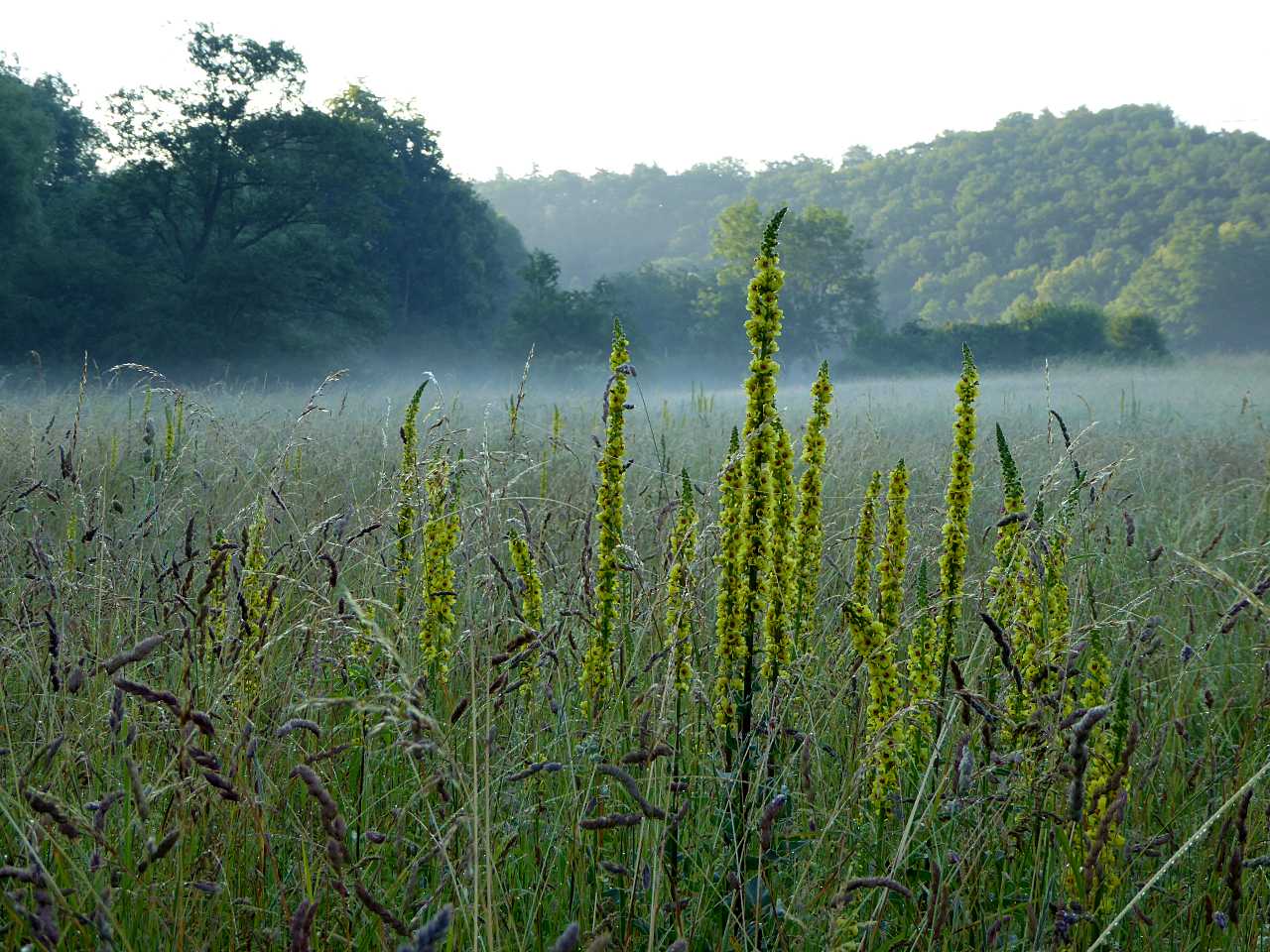
Summerly morning mist over our riverbanks in the Weidatal © SPA
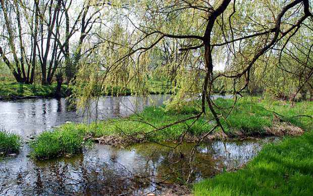
Undisturbed still water area on the Weida © SPA
Our riverbank meadows along the Weida © SPA
Based on this preliminary study and against the background of our extensive land ownership in the study area (approx. 75%), we applied in 2019 to the Greiz district local nature conservation agency for the study area to be designated a "protected landscape element".
Since 2005 we have been buying wet and semi-arid meadow plots along the 1.1 km long section of the Weida river, damp alluvial woodland areas, semi-arid to dry hillside woodland and former semi-arid grassland. Our current land ownership in 2021 is 26.0 ha (260,000 m²) of land.
In 2012, with the approval of the Greiz district local nature conservation agency, we created a standing body of water in one of our meadow plots to bolster the reptile population in the wet meadows of the Weida Valley. This is now populated by bullrushes and is a valuable food biotope for the Common Frog and the Grass Snake.
Through biotope-adapted maintenance measures such as extensive use of the meadowland once or twice mown hay meadows with mowing dates late in the year, we significantly improve the ecological value of the grassland areas to strengthen and protect the biodiversity of the fauna and flora.
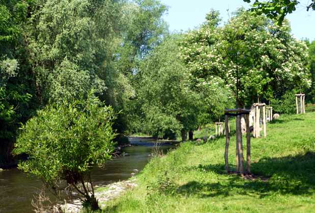
Renaturated riverbank on Foundation property © SPA
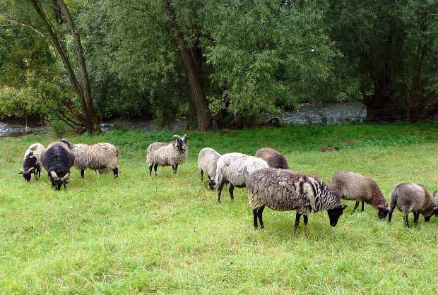
Landscape maintenance with Skudde sheep © SPA
We conduct negotiations with authorities and building authorities, up to and including legal disputes, to avoid as far as possible construction measures that cause harm to biotopes and species on Foundation-owned areas in the future protected landscape element "Weida-Floodplain with hillside forests".
Further purchases of land are planned for the future.
Common Kingfisher, Golden Oriole, Common Cuckoo, Red-backed Shrike, Red Kite, Long-eared Owl, Grass Snake, Sand Lizard
Common Kingfisher
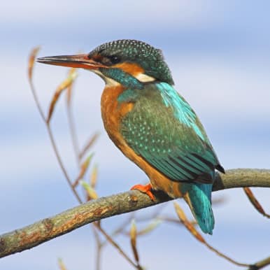
© Dr. P. Wernicke
Golden Oriole
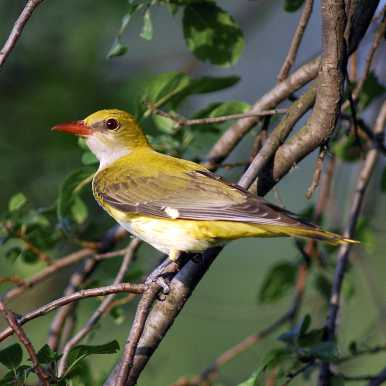
© Leo/fokus-natur
Common Cuckoo
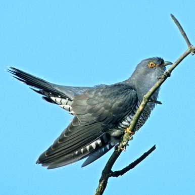
© Leo/fokus-natur
Red-backed Shrike
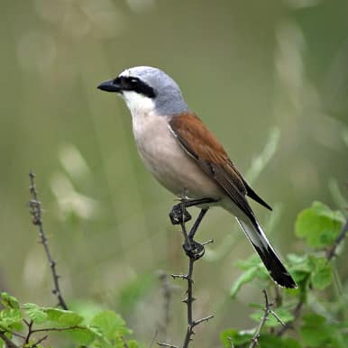
© Leo/fokus-natur
Red Kite

© Pröhl/fokus-natur
Long-eared Owl
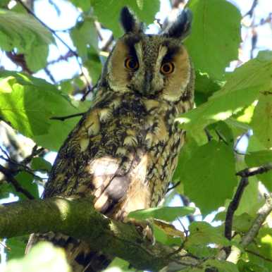
© SPA
Grass Snake
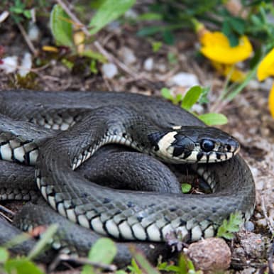
© Leo/fokus-natur
Sand Lizard
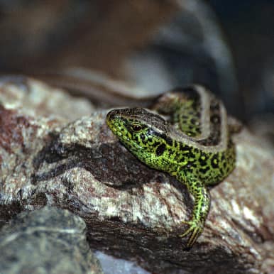
© Leo/fokus-natur
Please help us to preserve more wet meadows and hillside woodland through purchase. Every donation helps.
The information on the copyrights of the images used on this site can be found at Copyrights, unless these are already indicated in or below the image.
This year’s early summer population surveys at our five species conservation towers in the Rhineland have once again highlighted their great regional importance for bird species that use buildings. Despite encouraging occupancy figures, a worrying trend is becoming increasingly evident: insectivorous bird species are in decline... more information
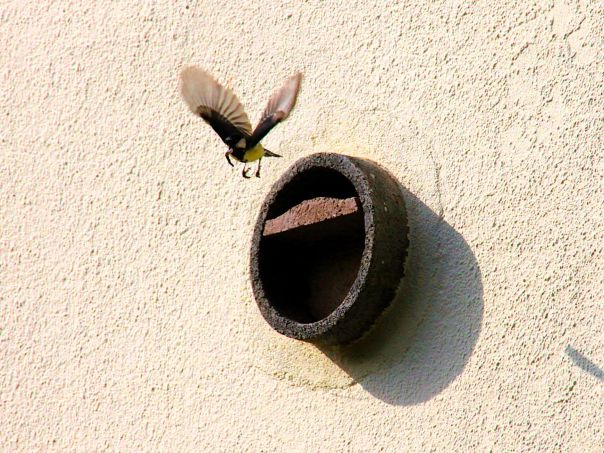
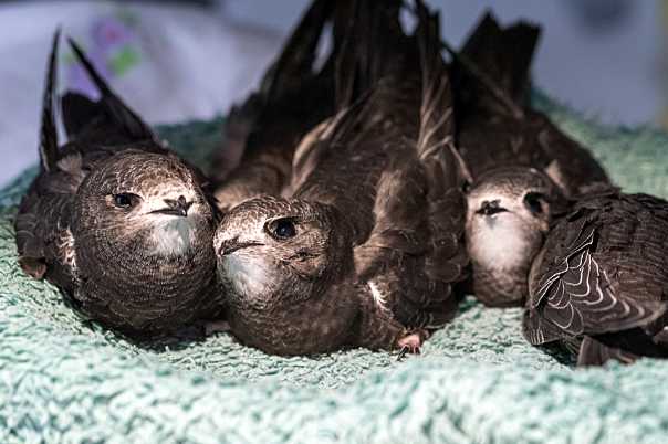
Our increasingly technological environment is posing a growing threat to Swifts: a shortage of insects, building renovations, glass façades, and overheated roofs are putting these fascinating non-stop flyers at ever greater risk.
The Frankfurt Swift Clinic helps where rescue is still possible – please support this unique work to help migratory birds... to the project
Postbank Hannover IBAN: DE47 2501 0030 0905 9063 07 BIC: PBNKDEFF
Stiftung Pro Artenvielfalt Meisenstraße 65 33607 Bielefeld Germany Tel. (0049) 0521 2997-883 / -884 / -889 Fax (0049) 0521 2997-885 Office Mo - Fr. 09.00 to 16.00
Foundation Management team@stiftung-pro-artenvielfalt.org Project Management projekte@stiftung-pro-artenvielfalt.org Donations, Donor Care service@stiftung-pro-artenvielfalt.org
 Donate now